
Walk a Franklin Street by Address
A Franklin street directory works best as a chain of official address records. No single roll names everyone in a home. Begin with the physical address, locate its parcel, and then test what each later source actually proves. The Johnson County Assessor can identify the owner of record. The Recorder can establish transfers. Directories and released census schedules may add occupants from an earlier period. Each source answers a different question, so keep owner, voter, permit applicant, and resident as separate roles.
- Normalize the house number, direction, street type, unit, and Franklin postal label. Search the address in Johnson County Beacon.
- Record the parcel ID, situs address, owner, legal description, and result date. Open the official GIS map and browse the parcel polygons along the road.
- Use the owner and legal description in the Recorder index. A deed is commonly indexed by party and land description, not just street name.
- For an individual voter, use Indiana Voters. A public whole-street browse is not offered through that portal.
- For an old household, consult the Franklin directory runs and Sanborn maps. Confirm any occupant clue with another dated record.
The process should stay narrow. A whole-street project can be built parcel by parcel in the map, but that does not turn the assessor roll into proof of who sleeps at each address. If the live map will not load, ask the Assessor for an existing street or parcel list under Indiana's Access to Public Records Act. The office does not have to create a new list that it does not maintain.
Save enough detail to repeat each Franklin search. A useful working note has the normalized address, parcel ID, situs field, legal description, owner role, portal date, and document number. Add a short statement of what the record does not prove. This keeps a later deed, permit, or directory match from being mistaken for a full household list. If two sources conflict, return to the custodian rather than choosing the result that seems newest.
Search Franklin Parcels in Beacon
Johnson County Beacon is the official address, owner, and parcel route described by the county. The live Schneider screen was blocked during research, so the county FAQ supplies the verified search modes while exact field labels and required controls remain unconfirmed. Do not promise a ZIP filter or a one-click street list.
| Search route | Verified use | Likely result value | Limit |
|---|---|---|---|
| Owner name | Confirmed by county FAQ | Owner, parcel, values, tax and deduction detail | An owner may be a trust or business |
| Address | Confirmed by county FAQ | Parcel at a situs address | Exact street and ZIP controls were not captured |
| Parcel ID | Confirmed by county FAQ | Direct parcel card and map placement | Keep the county's exact number format |
The captured Beacon property-search landing screen shows where a Franklin street directory begins. It is a portal entry, not a resident list.
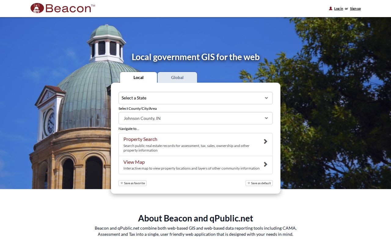
Once a parcel card opens, note both the physical location and the mailing field before moving to the map or deed index.
Franklin Street Record Terms
Several short labels keep an address search accurate. They also prevent a common mistake: treating a tax contact address as the place where a person lives.
- Parcel
- The county's land unit, tied to an ID and legal description.
- Situs address
- The physical location of the land or building.
- Mailing address
- Where assessment mail goes; it can belong to a trustee, business, agent, or owner elsewhere.
- Plat
- A recorded map showing lots, blocks, streets, easements, and subdivision geometry.
- Criss-cross directory
- A historical directory arranged by street or telephone number instead of only by surname.
A legal description can survive a renamed or renumbered road. Research found no verified Franklin-wide renumbering year. When an old number vanishes, compare the plat, Sanborn block and house number, cross streets, and parcel description rather than inventing a date.
Browse Franklin Streets on GIS
The Johnson County GIS entry now routes toward Beacon. The county describes an interactive map with owner, address, and parcel identification, aerial and parcel layers, distance tools, printing, and feature identification. For a street-by-street search, zoom to the road, click each parcel polygon, record its parcel ID and lot, then open its property detail.
Exact button names and the enabled local layers were not visible during research. Describe only map browsing and adjacent-parcel clicking. Do not claim a buffer or radius tool. Useful layers may include roads, parcels, city limits, zoning, flood areas, subdivisions, and public districts, but availability must be checked in the live county configuration.
Parcel lines show land, not households. A polygon can contain more than one unit, and an address can fall in the Franklin postal area while outside the incorporated city. Map placement should be checked against municipal boundaries before a city agency is asked for a permit or code file.
Franklin Street Directory Record Set
Address-keyed sources vary in strength. Use this Franklin coverage table to choose a custodian and to avoid asking one record to prove more than it can.
| Address source | Franklin keeper | What it establishes | Access route |
|---|---|---|---|
| Assessor parcel card | Johnson County Assessor | Owner, situs, mailing field, parcel, values, deductions, sales history | Beacon, counter, or phone |
| GIS parcel map | Johnson County GIS | Road, parcel shape, nearby lots, aerial context, and public layers | jcmaps or Beacon |
| Deed and mortgage index | Johnson County Recorder | Grantor, grantee, instrument, date, and legal description | EON/Tapestry or Recorder counter |
| Permit and planning file | Franklin or county planning | Dated work, applicant, parcel, hearing, and decision | OpenGov, packets, office, or APRA |
| Directory and Sanborn map | JCPL, Museum, State Library | Historical occupant clue and building context | Room, scan, database, or staff request |
The parcel ID and legal description are the strongest bridges. Street spelling can change, while the recorded lot or land description persists. A voter status result is an individual clue, not a street roll; bulk voter data follows a separate VRG-24 request and use agreement, with protected Address Confidentiality Program information withheld.
Carry a Franklin Address to Deeds
Translate the address into a parcel, subdivision, lot, block, or other legal description before opening the Johnson County land-record search. Tapestry and EON support party names, document number and type, recording dates, consideration, subdivision, lot and block, parcel, and section, township, range, and quarter fields. The document number is the cleanest repeatable key.
The Recorder EON entry image shows the official vendor route used after Beacon supplies the current owner and land identity.

For each deed, record grantor, grantee, instrument type, date, document number, and matching legal description. A street name alone may miss the instrument.
Johnson County has not published one continuous online starting year. When a result is absent, use the Recorder counter and the State Library microfilm runs for deed indexes beginning in 1825. Online image access and current vendor charges also need live confirmation.
Franklin Permits Add Dated Evidence
The Franklin OpenGov permit portal provides a municipal starting point for permits and inspections, though its public fields were not captured. Search an exact address and date range, then separate applicant, contractor, owner, work description, issue date, inspection event, and status. An applicant is not automatically a resident.
Code Compliance accepts reports and can be reached at 317-736-3660, but no public case search was located. Ask for an existing case by address, number, and date through the city APRA form. Planning and Board of Zoning Appeals files can add the petitioner, parcel, proposed use, hearing date, conditions, and action. Franklin Planning is at 70 E Monroe Street; county Planning handles the appropriate out-of-city cases at 86 W Court Street.
Determine jurisdiction first. A 46131 mailing label alone does not settle whether the city or Johnson County holds the file.
Planning records can explain why an address appears under a different use or parcel arrangement. Board packets may identify a petition, hearing, conditions, or land split. Search by address and applicant, then compare the parcel description. Public works files, easements, and assessments can help when a road changed. Utility account identities should not be requested as a street roster.
Read Old Franklin Streets Carefully
Franklin's printed runs include 1931 and 1935 volumes, mid-century editions, later runs from 1969 through 1978, and Haines or Polk editions listed through 2013. A reverse section, when present, can turn a street number into a name. Exact reverse-section coverage has not been verified for every edition, so consult the abbreviation key and street list before assuming that feature exists. The Franklin city directory collections are covered separately.
Sanborn fire-insurance maps add another address layer for 1886, 1892, 1896, 1902, 1910, 1916, 1927, and update material through 1948. They show footprints, building use, materials, heights, and house or block numbers. They do not identify occupants. Pair a map year with a directory entry and a deed that matches the land.
This distinction matters in Franklin because “Franklin” can mean an incorporated city, the 46131 postal area, or a post-office label in an old county record. The 1895 land directory may describe rural land served through Franklin, not a home inside today's boundary.
Franklin Streets Cross Postal Lines
ZIP 46131 is the working Franklin postal area, but it is not a legal city boundary. A Franklin mailing label can reach a Johnson County parcel outside the incorporated city. USPS answers where mail goes; county GIS and city-limit layers answer which government controls the parcel. Both can be correct.
That split changes the request path. Use the parcel map before contacting Franklin Planning, Code Compliance, or the county office. Historical records need even more care. A “Franklin” post office entry in the 1895 county directory may describe rural land in a township rather than a street within today's city. Section, township, range, acreage, and plats can place it more accurately than a modern ZIP.
USPS does not verify ownership or occupancy. Keep its result as an address-format check, then return to the assessor, Recorder, and dated household records.
Franklin Street Directory Limits
A parcel card names an owner or tax contact, not every resident, visitor, family member, or person receiving mail. A current owner can be deceased, represented by an estate, or listed through a trust or business. Renters may never appear in the parcel roll. Homestead deductions support a tax classification but do not prove each current occupant.
Indiana's voter portal checks one person and does not publish a street browse. Protected voters are withheld. Motor-vehicle address data is restricted, and utility customer names should not be treated as a public directory. Commercial compilations can also be stale or merge people with similar names. Confirm a Franklin street directory result at the office that created the record.
Lawful use. Use Franklin address records for lawful personal research, property history, or civic review. Never use them to stalk, harass, threaten, or expose a protected person.
When a record is wrong, contact its custodian. The Assessor handles parcel fields, the Recorder handles recorded instruments, and the city or county planning office handles its own case files. An APRA request can seek an existing record, but it cannot force an office to build a new street roster.